Millhill of Wandel Excavation Report
Download the Millhill of Wandel report and adjunct survey of Hartside and Devonshire
Survey and excavation reports – Millhill of Wandel
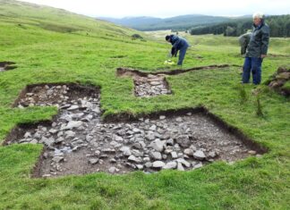
From 2019 until 2022 excavations were undertaken at Millhill of Wandel. This came about as a follow-up to observations taken from Wandel Mill and a subsequent survey. No records had been published of this site other than some aerial...
Camps Reservoir excavation and survey report from 1992
A survey and partial excavation of a series of Bronze Age and later structures exposed by the lowering of the water level in Camps Reservoir was carried out in 1992 and 1994. In the first campaign of work an enclosed cremation...
Reservoirs 2021 – exceptionally low water levels
Revisiting some of our past excavations sites recently found the reservoirs are particularly low this year.
Some background information
The four reservoirs are Talla, Fruid and Megget, all in Borders Region and Daer in South Lanarkshire. Various campaigns of work have...
David Fisher – Artist (1946-2013), his Clydesdale legacy
By Tam Ward
David Fisher was born in Midsomer Norton in Somerset, he originally trained as a signwriter and decorator and gradually became a self employed artist. He was commissioned to paint pub signs all over England and produced a...
Digitised M74 Report from 1992
The out of print report by Tam Ward on the survey work by the Biggar Archaeology Group as part of the M74 upgrade in Clydesdale, now South Lanarkshire, in 1990, it has now been digitised.
Upper Clydesdale through the Ages...
Six Castles and a Bastle in Upper Clydesdale
This report features a localised grouping of castle sites and a bastle house that are given as a guide to defensive sites dating from the 12th to the 17th centuries in Upper Clydesdale, South Lanarkshire.
Map showing locations of sites...
Excavations and consolidation works at Covington Tower and Doocot, South Lanarkshire
Covington Tower and doocot represent the best sites of their types in the Upper reaches of the River Clyde in South Lanarkshire. The site is located at NS 975 400 and lies immediately on the west side of an...
Glenochar Bastle House and Fermtoun
An account of the discovery, survey, consolidation, excavations and research of a 17th-century defensive farmhouse and buildings in Clydesdale, with supplementary contextual information.
This Glenochar Bastle House and Fermtoun report replaces all previous works on the site, but much is...
Daer Reservoir
Daer Reservoir
The Daer Reservoir supplies water to the central belt of Scotland and it was inaugurated by Her Majesty The Queen in 1956. It has never been empty since that time but its water level routinely falls in the...
Daer Valley
The Daer Valley was initially visited in the search for bastle house sites, three were discovered; Wintercleuch, Smithwood and Kirkhope.
The valley was re-visited for the M74 Project in 1990 and the area within the reservoir was also inspected in...
Clydesdale Upland Survey
Clydesdale Survey
The upland surveys undertaken by the Group and by the writer in a commercial capacity for pre-aforestation surveys, principally in The Clyde and Tweed Valleys but also in numerous other locations of the Southern Uplands of Scotland, has...
Wildshaw Burn
Wildshaw Burn Stone Circle
The monument consists of 23 stones arranged in an almost perfect ellipse. Its long axis, 52m in length, is aligned NNE-SSW; the short axis is 42m long.
The circle lies between the new M74 motorway and...
Bastle Houses and Sheep Buchts
Bastle Houses and Sheep Buchts
Coming from zero in terms of knowledge of these sites, we have now recorded bastles or possible bastles, countless sheep milking buchts and numerous shieling sites. The emerging scenario depicts tenant farmers, rearing sheep and...
Daer Valley and Clydesdale Mesolithic Report
Biggar Archaeology Group PDF Reports. info@biggararchaeology.org.uk
Latest Reports – Crossing the Clyde, On Tintock Tap, two reports on mesolithic Daer...
Biggar Archaeology Group PDF Reports. info@biggararchaeology.org.uk
17th Century Settlement of Coom partial excavation in
Download – Partial Excavation of the 17th Century Settlement of Coom in the Daer Valley | 1.5MB | Tam Ward, BAG |
Survey and excavation trenches produced evidence of a series of buildings, their floors and finds dating to the...
Glendorch Bastle House partial excavation in 1985-86
Download – The partial excavation of Glendoroch Bastle House, near Crawfordjohn, South Lanarkshire | 1.5MB | 2015 | Tam Ward, BAG | Partial excavation of a previously unrecorded building showed it to belong to the Bastle House tradition of...
Winter Solstice from Daer sites
Biggar Archaeology Group PDF Reports. info@biggararchaeology.org.uk


