Clydesdale Project
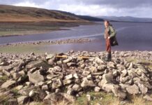
This major project evolved from a study of bastle houses into a wide-ranging investigation of the archaeology of Upper Clydesdale. It is subdivided into various topics of which the main ones are The Daer Valley Project, the on-going Bastle Houses Project and the Upland Survey Project.
How it all started
During the course of searching for bastle house sites, the Group were surprised to be discovering un-recorded sites of all periods but most especially for the pre-historic era and in particular for the Bronze Age.
A plan was devised to search and survey the whole of the Upper Clydesdale landscape and this was underway when in 1989 the announcement that the remaining part of A74 road was to be upgraded to a six lane motorway. The most northerly part of this work stretched from Douglas in the north through Crawford Parish and into Dumfriesshire.
We waited for some archaeological response to this development which for the most part traversed completely undeveloped land. When none appeared, we undertook the survey work ourselves and found the expected range of un-recorded sites. However, one new site in particular focused attention on both us and the landscape; that was the Wildshaw Burn Stone Circle (Ward, 1992).
Since most of the survey was already done by us on a voluntary basis, it was decided to extend the survey area away from the direct line of the road corridor and their ancillary works, to allow a better perspective of the landscape. This was a golden opportunity not to be missed by the Biggar archaeologists who continued with renewed vigour and the outcome was that nearly all of the Upper Clydesdale landscape was eventually surveyed. This was published by Biggar Museums as The Upper Clydesdale through the Ages – M74 Project (1992).
GUARD were also commissioned to carry out several excavations on the new route and these produced significant results, nearly all relevant to the Bronze Age, one aspect being to show that Unenclosed Platform Settlements extended in date range for the entire Bronze Age period (Terry, 1995).
There are still a few small peripheral packages of land awaiting inspection and when this has been done we believe that practically all of the visible monuments for this part of Lanarkshire will be finally recorded. Nevertheless we know that there will still be many sites, monuments and finds which will only ever be brought to light by some disturbance of the ground.
Clydesdale project related news


